Your web browser is no longer supported. To improve your experience update it here
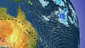
Australian weather forecast
National weather
Rain Radar map
12:40 AEDT12:45 AEDT12:50 AEDT12:55 AEDT13:00 AEDT13:05 AEDT13:10 AEDT

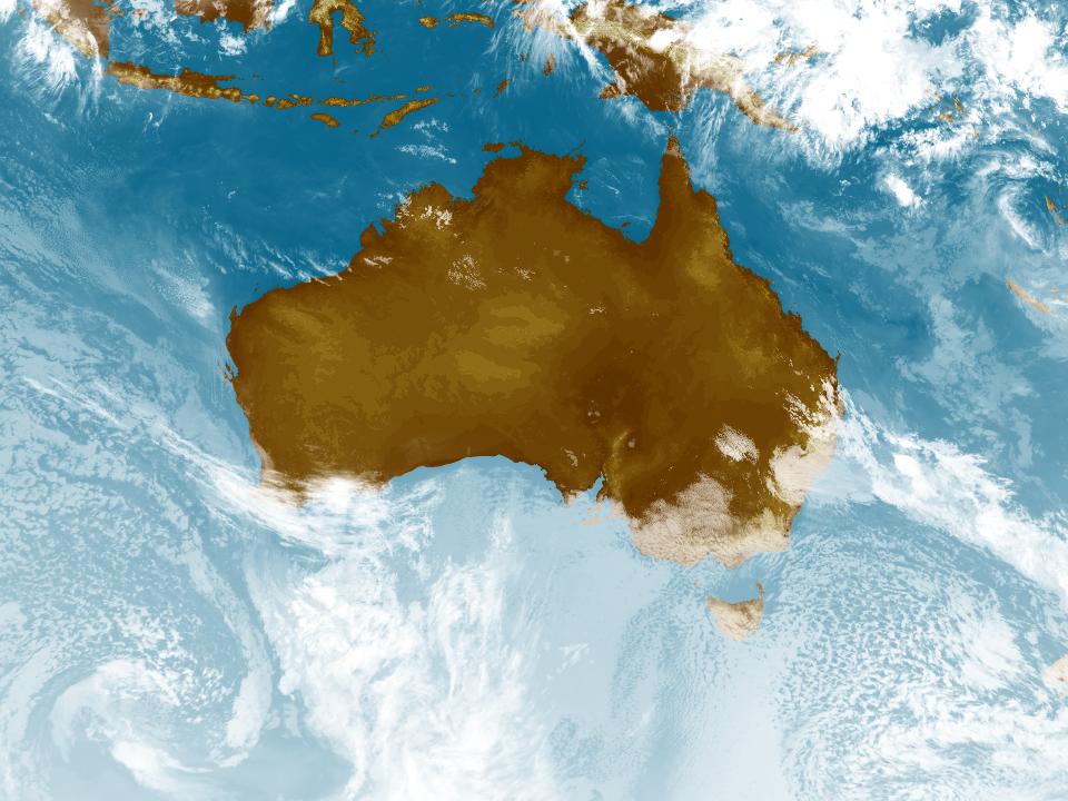
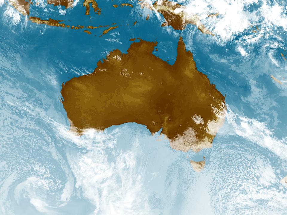
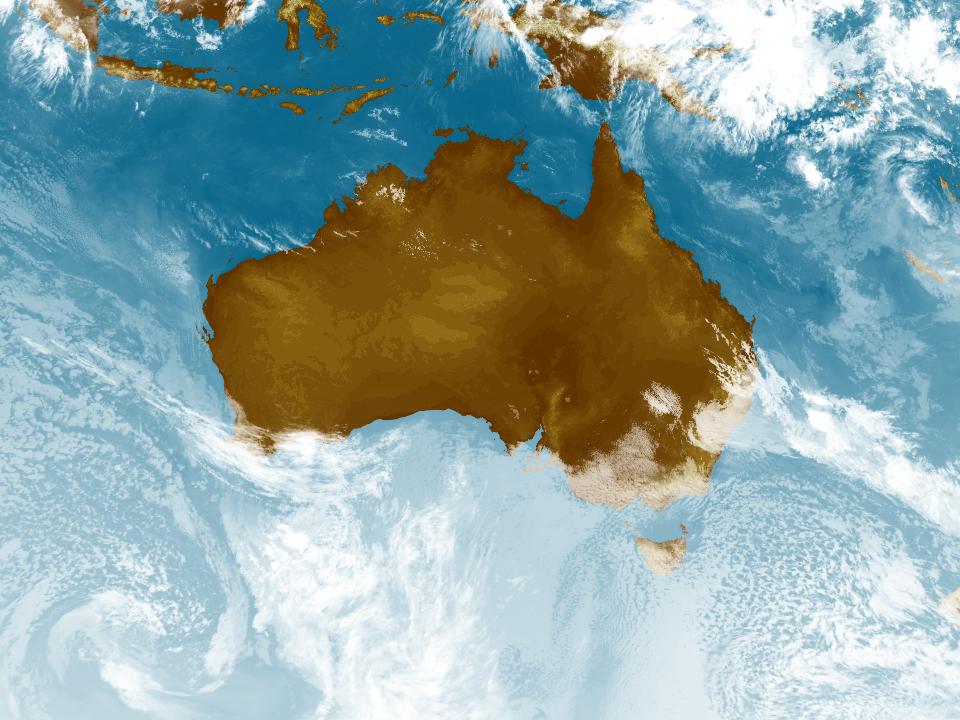
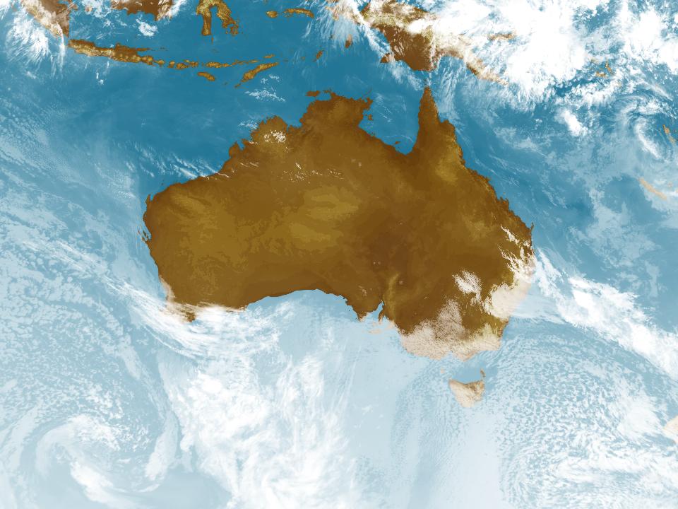
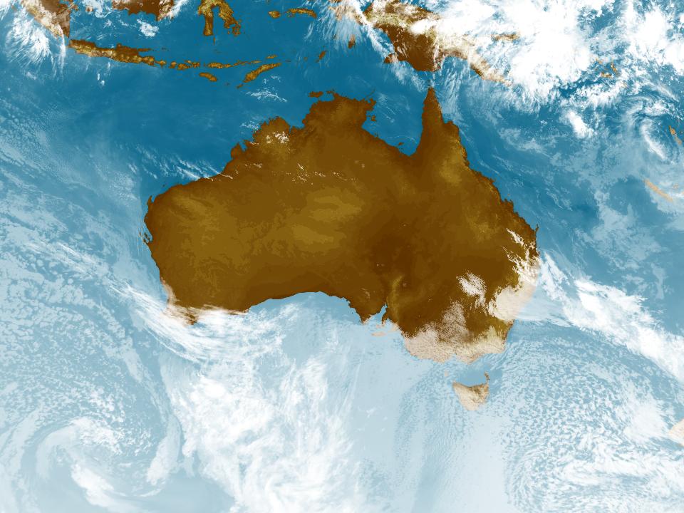
Weather Satellite
11:40 AEDT12:00 AEDT12:10 AEDT12:30 AEDT12:40 AEDT12:50 AEDT13:00 AEDT


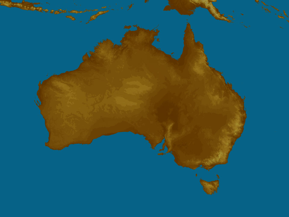
Synoptic weather chart
View national synoptic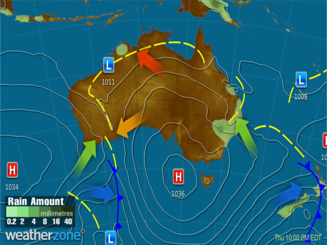
Thursday 12:10 EST
A high will cause brisk winds and showers to ease in SA, TAS and VIC. Strong southerly winds and a trough will causes showers and storms over eastern NSW and southeast QLD. Another trough will trigger the odd storm for inland/north WA, while drawing heat in the north.
Issued Wednesday 22:10 EST
Weather warnings
Gale Warning for Esperance Coast. Strong Wind Warning for Ningaloo and Eucla coasts. Cancellation for Albany Coast
Australian Government Bureau of Meteorology Western Australia Marine Wind Warning Summary for Western Australia Issued at 10:00 AM WST on Thursday 26 October 2023 for the period until midnight WST Friday 27 October 2023 Wind Warnings for Thursday 26 October Gale Warning for the following areas: Esperance Coast Strong Wind Warning for the following areas: Ningaloo Coast and Eucla Coast Cancellation for the following areas: Albany Coast Wind Warnings for Friday 27 October Strong Wind Warning for the following areas: Ningaloo Coast, Gascoyne Coast, Geraldton Coast, Esperance Coast and Eucla Coast The next marine wind warning summary will be issued by 4:00 pm WST Thursday. ================================================================================ Check the latest Coastal Waters Forecast or Local Waters Forecast at http://www.bom.gov.au/wa/forecasts/map.shtml for information on wind, wave and weather conditions for these coastal zones. ================================================================================Strong Wind Warning for Friday for Roper Groote Coast
Australian Government Bureau of Meteorology Northern Territory Marine Wind Warning Summary for the Northern Territory Issued at 10:00 AM CST on Thursday 26 October 2023 for the period until midnight CST Friday 27 October 2023 Wind Warnings for Friday 27 October Strong Wind Warning for the following areas: Roper Groote Coast The next marine wind warning summary will be issued by 4:00 pm CST Thursday. ================================================================================ Check the latest Coastal Waters Forecast or Local Waters Forecast at http://www.bom.gov.au/nt/forecasts/map.shtml for information on wind, wave and weather conditions for these coastal zones. ================================================================================Gale Warning For Western Area
Australian Government Bureau of Meteorology Head Office (Bureau National Operations Centre) Gale Warning For Western Area Issued at 11:23 AM EDT on Thursday 26 October 2023 ================================================================================ Please be aware Wind and wave forecasts are averages. Wind gusts can be 40 per cent stronger than the forecast, and stronger still in squalls and thunderstorms. Maximum waves can be twice the forecast height. ================================================================================ Weather Situation Vigorous flow developing associated with a cold front, forecast near 42S124E 45S124E at 261500UTC, and near 43S126E 46S125E at 261800UTC. 0700 UTC 26 October 2023Sheep Graziers Warning for Flinders, Mid North, Mount Lofty Ranges, Murraylands, Upper South East & Lower South East
Australian Government Bureau of Meteorology South Australia Warning to Sheep Graziers for Mount Lofty Ranges, Flinders, Mid North, Murraylands, Upper South East and Lower South East forecast districts Issued at 10:46 AM CDT on Thursday 26 October 2023 Warning to Sheep Graziers for the following areas: Mount Lofty Ranges, Flinders, Mid North, Murraylands, Upper South East and Lower South East forecast districts Sheep graziers are warned that cold temperatures and southeasterly winds are expected during Thursday and Friday. Areas likely to be affected include parts of the Mount Lofty Ranges, Flinders, Mid North, Murraylands, Upper South East and Lower South East forecast districts. There is a risk of losses of lambs and sheep exposed to these conditions. Cancellation of Warning to Sheep Graziers for the following areas: West Coast, Lower Eyre Peninsula, Yorke Peninsula, Riverland, North West Pastoral and North East Pastoral forecast districts The Warning to Sheep Graziers for the West Coast, Lower Eyre Peninsula, Yorke Peninsula, Riverland, North West Pastoral and North East Pastoral forecast districts has been cancelled. The next warning will be issued by 5:00 pm CDT Thursday.Cancellation Of Bush Walkers Weather Alert for Western and Central Plateau
Australian Government Bureau of Meteorology Tasmania Cancellation Of Bush Walkers Weather Alert for Western and Central Plateau forecast districts Issued at 11:14 AM EDT on Thursday 26 October 2023 Cancellation of Bush Walkers Weather Alert for the following areas: Western and Central Plateau forecast districts The Bush Walkers Weather Alert for the Western and Central Plateau forecast districts has been cancelled. No further warnings will be issued for this event.Sheep Graziers Warning for South East. Cancelled Sheep Graziers Warning for Midlands, Upper Derwent Valley & North West & East coasts
Australian Government Bureau of Meteorology Tasmania Warning to Sheep Graziers for South East forecast district Issued at 11:13 AM EDT on Thursday 26 October 2023 Warning to Sheep Graziers for the following areas: South East forecast district Sheep graziers are warned that cold temperatures, showers and strong southwesterly winds are expected during Thursday. Areas likely to be affected include parts of the South East forecast district. There is a risk of losses of lambs and sheep exposed to these conditions. Cancellation of Warning to Sheep Graziers for the following areas: North West Coast, Midlands, East Coast and Upper Derwent Valley forecast districts The Warning to Sheep Graziers for the North West Coast, Midlands, East Coast and Upper Derwent Valley forecast districts has been cancelled. The next warning will be issued by 5:00 pm EDT Thursday.Sheep Graziers Warning for Mallee, Wimmera, Northern Country, North Central, North East, South West & Central
Australian Government Bureau of Meteorology Victoria Warning to Sheep Graziers for Mallee, Wimmera, Northern Country, North Central, North East, South West and Central forecast districts Issued at 11:12 AM EDT on Thursday 26 October 2023 Warning to Sheep Graziers for the following areas: Mallee, Wimmera, Northern Country, North Central, North East, South West and Central forecast districts Sheep graziers are warned that cold temperatures and southerly winds are expected during Thursday and Friday morning. Areas likely to be affected include the North Central forecast district and parts of the Mallee, Wimmera, Northern Country, North East, South West and Central forecast districts. There is a risk of losses of lambs and sheep exposed to these conditions. Cancellation of Warning to Sheep Graziers for the following areas: West and South Gippsland and East Gippsland forecast districts The Warning to Sheep Graziers for the West and South Gippsland and East Gippsland forecast districts has been cancelled. The next warning will be issued by 5:00 pm EDT Thursday.Sheep Graziers Warning N Rivers, Hunter, N Tablelands, Illawarra, C Tablelands, S Tablelands, NW Slopes & Plains, CW Slopes/Plains
Australian Government Bureau of Meteorology New South Wales Warning to Sheep Graziers for Northern Rivers, Mid North Coast, Hunter, Northern Tablelands, Illawarra, Central Tablelands, Southern Tablelands, North West Slopes & Plains, Central West Slopes & Plains, South West Slopes, Riverina, Snowy Mountains and Australian Capital Territory forecast districts Issued at 11:11 AM EDT on Thursday 26 October 2023 Warning to Sheep Graziers for the following areas: Northern Rivers, Mid North Coast, Hunter, Northern Tablelands, Illawarra, Central Tablelands, Southern Tablelands, North West Slopes & Plains, Central West Slopes & Plains, South West Slopes, Riverina, Snowy Mountains and Australian Capital Territory forecast districts Sheep graziers are warned that cold temperatures, showers and southeasterly winds are expected during Thursday and Friday. Areas likely to be affected include the Mid North Coast, Southern Tablelands, South West Slopes, Snowy Mountains and Australian Capital Territory forecast districts and parts of the Northern Rivers, Hunter, Northern Tablelands, Illawarra, Central Tablelands, North West Slopes & Plains, Central West Slopes & Plains and Riverina forecast districts. There is a risk of losses of lambs and sheep exposed to these conditions. Cancellation of Warning to Sheep Graziers for the following areas: South Coast, Upper Western and Lower Western forecast districts The Warning to Sheep Graziers for the South Coast, Upper Western and Lower Western forecast districts has been cancelled. The next warning will be issued by 5:00 pm EDT Thursday.Strong Wind Warning for Moreton Bay and Gold Coast Waters
Australian Government Bureau of Meteorology Queensland Marine Wind Warning Summary for Queensland Issued at 10:00 AM EST on Thursday 26 October 2023 for the period until midnight EST Friday 27 October 2023 Wind Warnings for Thursday 26 October Strong Wind Warning for the following areas: Moreton Bay and Gold Coast Waters Wind Warnings for Friday 27 October Gale Warning for the following areas: Sunshine Coast Waters and Gold Coast Waters Strong Wind Warning for the following areas: South East Gulf of Carpentaria, Mackay Coast, Capricornia Coast, Hervey Bay, Fraser Island Coast and Moreton Bay The next marine wind warning summary will be issued by 3:50 pm EST Thursday. ================================================================================ Check the latest Coastal Waters Forecast or Local Waters Forecast at http://www.bom.gov.au/qld/forecasts/map.shtml for information on wind, wave and weather conditions for these coastal zones. ================================================================================Gale Warning for Lower East Coast
Australian Government Bureau of Meteorology Tasmania Marine Wind Warning Summary for Tasmania Issued at 10:00 AM EDT on Thursday 26 October 2023 for the period until midnight EDT Thursday 26 October 2023 Wind Warnings for Thursday 26 October Gale Warning for the following areas: Lower East Coast Strong Wind Warning for the following areas: Derwent Estuary, Frederick Henry Bay and Norfolk Bay, Storm Bay, Channel, Far North West Coast, East of Flinders Island, Upper East Coast, South East Coast and South West Coast Cancellation for the following areas: Central West Coast The next marine wind warning summary will be issued by 4:05 pm EDT Thursday. ================================================================================ Check the latest Coastal Waters Forecast or Local Waters Forecast at http://www.bom.gov.au/tas/forecasts/map.shtml for information on wind, wave and weather conditions for these coastal zones. ================================================================================Strong Wind Warning for East Gippsland Coast. Cancellation for Central and Central Gippsland coasts
Australian Government Bureau of Meteorology Victoria Marine Wind Warning Summary for Victoria Issued at 10:00 AM EDT on Thursday 26 October 2023 for the period until midnight EDT Thursday 26 October 2023 Wind Warnings for Thursday 26 October Strong Wind Warning for the following areas: East Gippsland Coast Cancellation for the following areas: Central Coast and Central Gippsland Coast The next marine wind warning summary will be issued by 4:40 pm EDT Thursday. ================================================================================ Check the latest Coastal Waters Forecast or Local Waters Forecast at http://www.bom.gov.au/vic/forecasts/map.shtml for information on wind, wave and weather conditions for these coastal zones. ================================================================================Strong Wind Warning for Sydney Enclosed Waters & Byron, Coffs, Macquarie, Hunter, Sydney, Illawarra, Batemans and Eden coasts
Australian Government Bureau of Meteorology New South Wales Marine Wind Warning Summary for New South Wales Issued at 10:00 AM EDT on Thursday 26 October 2023 for the period until midnight EDT Friday 27 October 2023 Wind Warnings for Thursday 26 October Strong Wind Warning for the following areas: Sydney Enclosed Waters, Byron Coast, Coffs Coast, Macquarie Coast, Hunter Coast, Sydney Coast, Illawarra Coast, Batemans Coast and Eden Coast Wind Warnings for Friday 27 October Strong Wind Warning for the following areas: Byron Coast, Coffs Coast, Macquarie Coast, Hunter Coast, Sydney Coast and Illawarra Coast The next marine wind warning summary will be issued by 4:05 pm EDT Thursday. ================================================================================ Check the latest Coastal Waters Forecast or Local Waters Forecast at http://www.bom.gov.au/nsw/forecasts/map.shtml for information on wind, wave and weather conditions for these coastal zones. ================================================================================Final Flood Warning For The Huon River
Australian Government Bureau of Meteorology, Tasmania Final Flood Warning For The Huon River Issued at 09:45 AM EDT on Thursday 26 October 2023 By Bureau of Meteorology, Hobart Flood Warning Number: 2 FLOODING NO LONGER EXPECTED AT TAHUNE The Huon River at Tahune Bridge peaked below the minor flood level on Wednesday evening. Flooding is not expected downstream to Judbury and Huonville. In the 24 hours to 9 am Thursday, up to 40 mm of rainfall has been observed in the upper part of the catchment. Rainfall is expected to ease during Thursday. Huon River above Tahune: River levels are easing along the Huon River above Tahune. Picton River: No recent observations are available for the Picton River. Based on observed rainfall and surrounding gauges, river levels are likely easing. Huon River - Tahune to Judbury: No further flooding is expected in the Huon River from Tahune to Judbury. The Huon River at Tahune Bridge peaked below the minor flood level (4.00 metres) at 2.41 metres around 07:00 pm Wednesday evening. The river is currently at 1.80 metres and falling. The Huon River at Tahune Bridge is expected to remain below the minor flood level (4.00 metres) for the next few days. Huon River at Judbury: Cancellation Flood Safety Advice: SES flood warnings can be found at TasALERT www.alert.tas.gov.au Flood and storm safety advice is available at www.ses.tas.gov.au Road closure information is available at www.police.tas.gov.au} For emergency assistance call the SES on telephone number 132 500. For life threatening situations, call 000 immediately. Next issue: This is a final warning, no further warnings will be issued for this event. Latest River Heights: Huon River at Harrisons Opening,2.53,Falling,09:36 AM THU 26/10/23 Huon River at Tahune Bridge,1.80,Falling,09:22 AM THU 26/10/23 Huon River at Judbury,1.88,Falling,09:02 AM THU 26/10/23 Huon River at Huonville,1.45,Falling,09:34 AM THU 26/10/23 This advice is also available by dialling 1300 659 210. Warning, rainfall and river information are available at www.bom.gov.au/tas/flood. The latest weather forecast is available at www.bom.gov.au/tas/forecasts.Fire Weather Warning for Barkly and Gregory South East
Australian Government Bureau of Meteorology Northern Territory Fire Weather Warning for Barkly and Gregory South East fire weather districts Issued at 05:11 AM CST on Thursday 26 October 2023 Weather Situation Fresh and gusty southeasterly winds combined with hot and dry conditions will cause elevated fire dangers through central parts of the Northern Territory on Thursday and again on Friday. For the rest of Thursday 26 October: Catastrophic Fire Danger for the following areas: Barkly North Extreme Fire Danger for the following areas: Gregory South East and Barkly South For Friday 27 October: Catastrophic Fire Danger for the following areas: Barkly North Extreme Fire Danger for the following areas: Gregory South East and Barkly South Bushfires NT and NT Fire and Rescue Service advise you to: Action your Bushfire Survival Plan now. Monitor the fire and weather situation through your local radio station, www.securent.nt.gov.au, and www.bom.gov.au. Call 000 (Triple Zero) in an emergency. For information on preparing for bushfires go to www.securent.nt.gov.au. The next warning will be issued by 5:00 pm CST Thursday.Strong Wind Warning for Friday for Far West Coast
Australian Government Bureau of Meteorology South Australia Marine Wind Warning Summary for South Australia Issued at 05:10 AM CDT on Thursday 26 October 2023 for the period until midnight CDT Friday 27 October 2023 Wind Warnings for Friday 27 October Strong Wind Warning for the following areas: Far West Coast The next marine wind warning summary will be issued by 3:50 pm CDT Thursday. ================================================================================ Check the latest Coastal Waters Forecast or Local Waters Forecast at http://www.bom.gov.au/sa/forecasts/map.shtml for information on wind, wave and weather conditions for these coastal zones. ================================================================================Fire Weather Warning for Central West, North West, Channel Country and Maranoa and Warrego
Australian Government Bureau of Meteorology Queensland Fire Weather Warning for Central West, North West, Channel Country and Maranoa and Warrego fire weather districts Issued at 03:45 AM EST on Thursday 26 October 2023 Weather Situation Hot and dry conditions with fresh and gusty southeasterly winds will drive elevated fire dangers on Thursday. For the rest of Thursday 26 October: Extreme Fire Danger for the following areas: Central West, North West, Channel Country and Maranoa and Warrego The Queensland Fire and Emergency Services advises you to: Refer to your Bushfire Survival Plan now. Monitor the fire and weather situation through your local radio station, www.qfes.qld.gov.au/current-incidents and www.bom.gov.au. Call 000 (Triple Zero) in an emergency. For information on preparing for bushfires go to www.qfes.qld.gov.au. No further warnings will be issued for this event, but the situation will continue to be monitored and further warnings issued if necessary.Hazardous Surf Warning for Friday for Byron, Coffs, Macquarie, Hunter, Sydney, Illawarra, Batemans and Eden coasts
Australian Government Bureau of Meteorology New South Wales Hazardous Surf Warning for New South Wales Issued at 04:23 AM EDT on Thursday 26 October 2023 Weather Situation Surf and swell conditions are expected to be hazardous for coastal activities such as rock fishing, boating, and swimming in the following areas. Warnings for Friday 27 October Hazardous Surf Warning for the following areas: Byron Coast, Coffs Coast, Macquarie Coast, Hunter Coast, Sydney Coast, Illawarra Coast, Batemans Coast and Eden Coast NSW Police Force, Marine Area Command advise that: People should consider staying out of the water and avoid walking near surf-exposed areas. Rock fishers should avoid coastal rock platforms exposed to the ocean and seek a safe location that is sheltered from the surf. Boaters planning to cross shallow water and ocean bars should consider changing or delaying their voyage. Boaters already on the water should carry the appropriate safety equipment and wear a lifejacket. Boaters should remember to log on with their local Marine Rescue radio base, via VHF Radio or the Marine Rescue APP, and consider their safety management plan. The next warning will be issued by 5:00 pm EDT Thursday. ================================================================================ Check the Coastal Waters Forecast for information on wind, wave and weather conditions for these areas at http://www.bom.gov.au/nsw/ or on marine radio. ================================================================================Heatwave Warning
Australian Government Bureau of Meteorology TOP PRIORITY FOR IMMEDIATE BROADCAST Heatwave Warning Issued at 12:34 PM WST on Wednesday 25 October 2023 Warning for the following areas: Kimberley WA Health advises everyone in the affected areas to take the following actions: Severe heatwaves can be dangerous for many people, especially older people, babies, children, pregnant and breastfeeding women, people with medical conditions and people who are unwell. Seek a place to keep cool, such as your home, a library, community centre or shopping centre. Close your windows and draw blinds, curtains or awnings early in the day to keep the heat out of your home. If available, use fans or air-conditioners to keep cool. No further warnings will be issued for this event.Heatwave Warning
Australian Government Bureau of Meteorology TOP PRIORITY FOR IMMEDIATE BROADCAST Heatwave Warning Issued at 12:34 PM WST on Wednesday 25 October 2023 Warning for the following areas: Kimberley WA Health advises everyone in the affected areas to take the following actions: Severe heatwaves can be dangerous for many people, especially older people, babies, children, pregnant and breastfeeding women, people with medical conditions and people who are unwell. Seek a place to keep cool, such as your home, a library, community centre or shopping centre. Close your windows and draw blinds, curtains or awnings early in the day to keep the heat out of your home. If available, use fans or air-conditioners to keep cool. No further warnings will be issued for this event.Heatwave Warning
Australian Government Bureau of Meteorology TOP PRIORITY FOR IMMEDIATE BROADCAST Heatwave Warning Issued at 12:34 PM WST on Wednesday 25 October 2023 Warning for the following areas: Kimberley WA Health advises everyone in the affected areas to take the following actions: Severe heatwaves can be dangerous for many people, especially older people, babies, children, pregnant and breastfeeding women, people with medical conditions and people who are unwell. Seek a place to keep cool, such as your home, a library, community centre or shopping centre. Close your windows and draw blinds, curtains or awnings early in the day to keep the heat out of your home. If available, use fans or air-conditioners to keep cool. No further warnings will be issued for this event.Heatwave Warning
Australian Government Bureau of Meteorology TOP PRIORITY FOR IMMEDIATE BROADCAST Heatwave Warning Issued at 12:34 PM WST on Wednesday 25 October 2023 Warning for the following areas: Kimberley WA Health advises everyone in the affected areas to take the following actions: Severe heatwaves can be dangerous for many people, especially older people, babies, children, pregnant and breastfeeding women, people with medical conditions and people who are unwell. Seek a place to keep cool, such as your home, a library, community centre or shopping centre. Close your windows and draw blinds, curtains or awnings early in the day to keep the heat out of your home. If available, use fans or air-conditioners to keep cool. No further warnings will be issued for this event.Heatwave Warning
Australian Government Bureau of Meteorology TOP PRIORITY FOR IMMEDIATE BROADCAST Heatwave Warning Issued at 01:47 PM CST on Wednesday 25 October 2023 Warning for the following areas: Tiwi Warning for the following areas: Daly and Arnhem The NT Department of Health advises everyone in the affected areas to take the following actions: Extreme heatwaves can be dangerous for everyone. Severe heatwaves can be dangerous for many people, especially older people, babies, children, pregnant and breastfeeding women, people with medical conditions and people who are unwell. Seek a place to keep cool, such as your home, a library, community centre or shopping centre. Close your windows and draw blinds, curtains or awnings early in the day to keep the heat out of your home. If available, use fans or air-conditioners to keep cool. No further warnings will be issued for this event.Heatwave Warning
Australian Government Bureau of Meteorology TOP PRIORITY FOR IMMEDIATE BROADCAST Heatwave Warning Issued at 01:47 PM CST on Wednesday 25 October 2023 Warning for the following areas: Tiwi Warning for the following areas: Daly and Arnhem The NT Department of Health advises everyone in the affected areas to take the following actions: Extreme heatwaves can be dangerous for everyone. Severe heatwaves can be dangerous for many people, especially older people, babies, children, pregnant and breastfeeding women, people with medical conditions and people who are unwell. Seek a place to keep cool, such as your home, a library, community centre or shopping centre. Close your windows and draw blinds, curtains or awnings early in the day to keep the heat out of your home. If available, use fans or air-conditioners to keep cool. No further warnings will be issued for this event.Heatwave Warning
Australian Government Bureau of Meteorology TOP PRIORITY FOR IMMEDIATE BROADCAST Heatwave Warning Issued at 01:47 PM CST on Wednesday 25 October 2023 Warning for the following areas: Tiwi Warning for the following areas: Daly and Arnhem The NT Department of Health advises everyone in the affected areas to take the following actions: Extreme heatwaves can be dangerous for everyone. Severe heatwaves can be dangerous for many people, especially older people, babies, children, pregnant and breastfeeding women, people with medical conditions and people who are unwell. Seek a place to keep cool, such as your home, a library, community centre or shopping centre. Close your windows and draw blinds, curtains or awnings early in the day to keep the heat out of your home. If available, use fans or air-conditioners to keep cool. No further warnings will be issued for this event.Heatwave Warning
Australian Government Bureau of Meteorology TOP PRIORITY FOR IMMEDIATE BROADCAST Heatwave Warning Issued at 01:47 PM CST on Wednesday 25 October 2023 Warning for the following areas: Tiwi Warning for the following areas: Daly and Arnhem The NT Department of Health advises everyone in the affected areas to take the following actions: Extreme heatwaves can be dangerous for everyone. Severe heatwaves can be dangerous for many people, especially older people, babies, children, pregnant and breastfeeding women, people with medical conditions and people who are unwell. Seek a place to keep cool, such as your home, a library, community centre or shopping centre. Close your windows and draw blinds, curtains or awnings early in the day to keep the heat out of your home. If available, use fans or air-conditioners to keep cool. No further warnings will be issued for this event.Moderate Flood Warning For The Murray River
Australian Government Bureau of Meteorology, New South Wales Moderate Flood Warning For The Murray River Issued at 01:53 PM EDT on Wednesday 25 October 2023 Flood Warning Number: 7 BARHAM LIKELY TO PEAK NEAR THE MODERATE FLOOD LEVEL AROUND FRIDAY The main flood peak along the Murray River is now close to Barham, where a peak near the moderate flood level is likely, around Friday. River levels at Swan Hill and downstream are expected to remain below minor flood levels. Murray River downstream of Tocumwal to Barham: Moderate flooding is possible along the Murray River downstream of Tocumwal to Barham. The Murray River at Barham is currently at 5.70 metres and rising slowly, with minor flooding. The Murray River at Barham is likely to peak near the moderate flood level (5.80 m) around Friday. Murray River at Torrumbarry Weir: Cancellation Flood Safety Advice: In life threatening emergencies, call 000 (triple zero) immediately. If you require rescue, assistance to evacuate or other emergency help, ring NSW and VIC SES on 132 500. * Avoid drowning. Stay out of rising water, seek refuge in the highest available place. * Prevent damage to your vehicle. Move it under cover, away from areas likely to flood. * Avoid being swept away. Stay out of fast-flowing creeks and storm drains. * Never drive, ride or walk through flood water. Flood water can be DECEPTIVE and dangerous.} For more emergency information, advice, and access to the latest river heights and rainfall observations and forecasts: * NSW SES: www.ses.nsw.gov.au * VIC SES: www.emergency.vic.gov.au * RMS Live Traffic: www.livetraffic.com * VicRoads: www.vicroads.vic.gov.au * Latest River Heights and Rainfall Observations: www.bom.gov.au/nsw/flood/southwest.shtml * Latest NSW Warnings: www.bom.gov.au/nsw/warnings/ * Rainfall Forecasts: www.bom.gov.au/australia/meteye/ * BOM NSW Twitter: www.twitter.com/BOM_NSW Next issue: The next warning will be issued by 02:00 pm EDT on Friday 27 October 2023. Latest River Heights: Murray River at Albury,1.59,Steady,01:30 PM WED 25/10/23 Murray River at Corowa,2.96,Steady,01:30 PM WED 25/10/23 Murray River at Yarrowonga Downstream,2.22,Steady,01:30 PM WED 25/10/23 Murray River at Tocumwal,2.99,Steady,01:00 PM WED 25/10/23 Murray River at Echuca,90.62,Steady,01:00 PM WED 25/10/23 Murray River at Torrumbarry Weir,6.83,Steady,11:30 AM WED 25/10/23 Murray River at Barham,5.70,Rising,01:00 PM WED 25/10/23 Murray River at Swan Hill,3.65,Rising,01:00 PM WED 25/10/23 Murray River at Wakool Junction,6.42,Rising,01:00 PM WED 25/10/23 Murray River at Boundary Bend,5.19,Steady,01:00 PM WED 25/10/23 Murray River at Euston,46.12,Steady,01:00 PM WED 25/10/23 Murray River at Wentworth,29.29,Steady,01:00 PM WED 25/10/23 Edward River at Deniliquin,2.91,Steady,01:00 PM WED 25/10/23 Edward River at Stevens Weir Downstream,2.91,Steady,01:00 PM WED 25/10/23 Edward River at Moulamein,3.01,Steady,01:00 PM WED 25/10/23 This advice is also available by dialling 1300 659 210. Warning, rainfall and river information are available at www.bom.gov.au/nsw/flood. The latest weather forecast is available at www.bom.gov.au/nsw/forecasts.
Weather Articles
Data supplied byWeather Zone
News Just In

Entire US city told 'lock your doors' as police hunt mass shooter

Woman found dead at Sydney CBD school named as water polo coach
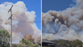
NSW woman jailed for pocketing $70k in illegal GST claims
:contrast(6):saturation(1.28)/https%3A%2F%2Fprod.static9.net.au%2Ffs%2F12047175-d144-4cef-b666-0fded9b05026)
Sydney bowling club green converted as little-known sport on the rise

Three people hospitalised after ambulance rollover in Melbourne's north

First Aussie Paris Olympian named as doubts hang over venue fitness

'Shiny shopfronts' hid $229 million criminal scheme: AFP

Truckers risk rego suspensions, heavy fines for tunnel height breaches

'This is a great honour': Albanese meets with Biden in Oval Office